
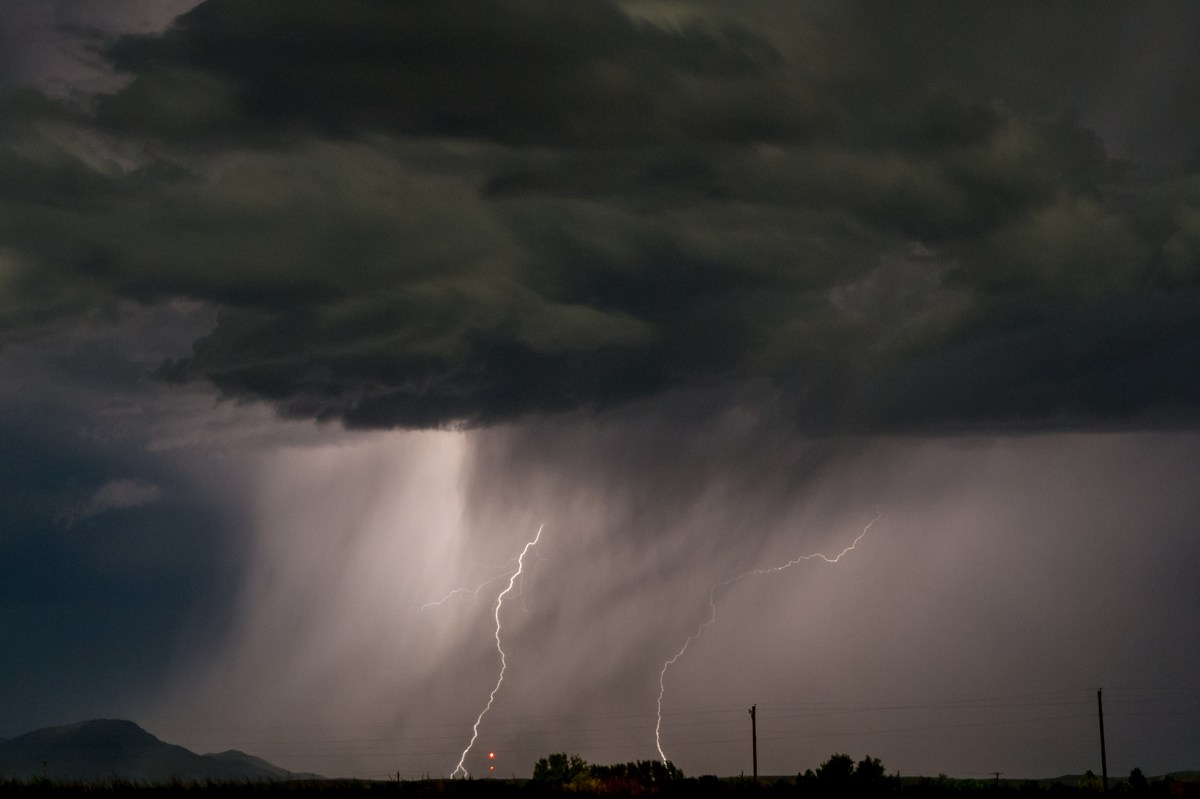
Severe thunderstorms packing “destructive” winds tore across parts of Illinois and Wisconsin on Wednesday afternoon, knocking out power to more than 200,000 people and prompting urgent warnings from the National Weather Service (NWS).
The storms hitting Wisconsin and Illinois are part of a much broader multiday severe weather outbreak stretching across the Midwest, where forecasters warned that widespread dangerous thunderstorms were possible through Thursday.
More than 200 million people could be impacted, AccuWeather reported, with major cities including Chicago, Milwaukee and Green Bay in an area at risk for repeated rounds of storms.
Meteorologists said the primary threats include powerful wind gusts that could reach 100 mph, large hail, possible tornadoes, and heavy rainfall that can trigger flash flooding.

Wisconsin, Illinois Severe Thunderstorms: What We Know
Nearly all of Wisconsin and much of Illinois were under severe thunderstorm warnings or watches as of late Wednesday afternoon. One severe thunderstorm warning issued by the NWS office in Green Bay at 3:38 p.m. local time warned that storms moving through Calumet and eastern Winnebago counties were capable of producing 90 mph wind gusts, describing the situation as “life-threatening” with “tornado like wind speeds expected.”
The agency said the line of storms was moving northeast at about 60 mph, impacting communities including Appleton, Menasha and areas along Lake Winnebago.
“These are destructive storms,” forecasters said, warning that flying debris could be deadly and that homes, businesses and mobile homes could be heavily damaged or destroyed, with widespread tree damage and power outages expected.
Animated weather footage from windy.com shows the current radar, depicting a line of severe thunderstorms stretching from Illinois up through Wisconsin.
As the storms moved through the state, outages climbed rapidly.
As of 3:54 p.m. Central time, more than 92,000 customers were without power statewide, according to data from poweroutage.us, representing about 3.1 percent of tracked users at the time of the latest update.
The outages span multiple utilities, with the largest impacts reported by:
- Alliant Energy: Nearly 44,000 customers without power
- We Energies: More than 21,000 outages
- Madison Gas & Electric: More than 10,000 outages
- Xcel Energy and Wisconsin Public Service: Several thousand outages each
County-level data showed some of the most severe disruptions in parts of southern and central Wisconsin. Separate local reporting indicated that more than 3,000 customers were already without power in Winnebago County alone during the early stages of the storm, with large clusters in Oshkosh and surrounding areas.
Illinois Power Outage Map
Illinois had even more outages, with nearly 120,000 outages reported as of 5:13 p.m. Eastern time. The majority of the outages were reported in Will County in Northeastern Illinois.
Several utilities were affected by the outages, including
- Commonwealth Edison Company: More than 105,00 without power
- Ameren: More than 10,000 without power
- Jo-Carroll Energy: More than 2,000 without power
Most outages were reported in northern and northeastern Illinois.
What Happens Next
While individual severe thunderstorm warnings are typically issued for relatively short periods as storms move quickly through an area, the broader threat is far from over. Forecasters cautioned that the same atmospheric setup driving Wednesday’s destructive storms is expected to persist into the evening and potentially into Thursday, meaning additional warnings—and possibly more severe storms—can be issued with little notice. As clusters of thunderstorms redevelop and track across Wisconsin and the surrounding Midwest, residents are urged to remain alert for updated alerts, as new rounds of damaging winds, hail or isolated tornadoes could quickly follow even after initial storms pass.
Tornado watches and severe thunderstorm watches remain in place across the Plains and Midwest as of 5 p.m. Eastern time on Wednesday.


Leave a Reply